Saturday (2 days ago) was World Oceans Day.
We made a small G+ post for it:
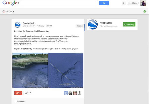
Google Earth: Revealing the Ocean on World Oceans Day!
Google Maps: On World Oceans Day, it's the perfect time to dive in and explore!
![Google Ocean for World Oceans Day]()
The text from the post and the image captions:
http://commondatastorage.googleapis.com/bathymetry/kml/NOAA-NGDC-OceanMapFootprints.kmz
Many thanks for the over 1000 +1's for the two G+ posts!
Google Earth: Revealing the Ocean on World Oceans Day!
Google Maps: On World Oceans Day, it's the perfect time to dive in and explore!

The text from the post and the image captions:
Here's a sneak preview of our work to improve our ocean map in
Google Earth and Maps in partnership with NOAA's National Geophysical
Data Center (http://goo.gl/zZpPB)
and the University of Colorado CIRES program (http://goo.gl/b3dGH).

Explore more today by downloading this Google Earth tour list http://goo.gl/jyDanHere

Visit a detailed ocean landscape in Boundary Bay, WA. NOAA's Crescent
Moegling says, "Within the Strait of Georgia, deep draft vessels
transit to several large refinery facilities. It's our job to provide
the mariner with the most accurate chart, with the most relevant
features and depths available for their safe navigation."

Notice the new high resolution 16 meter NOAA survey update (right)
relative to the lower 1 km resolution across the Canadian border
(left) in this area west of Bellingham, Washington.
The kmz showing the locations of the updates is here:
http://commondatastorage.googleapis.com/bathymetry/kml/NOAA-NGDC-OceanMapFootprints.kmz
Many thanks for the over 1000 +1's for the two G+ posts!